
Tabla de contenido
The current route of the Berlin Marathon, which starts and finishes at the Brandenburg Gate, has been in use since 1990. This change coincided with the reunification of Germany and allowed the marathon to become an event that symbolically united the eastern and western parts of Berlin.
Prior to 1990, the marathon was run only in West Berlin due to the city’s division by the Berlin Wall. With the fall of the Wall in 1989, a new route could be designed to cover the entire city, offering runners a more complete experience of Berlin and its historical monuments.
The Berlin Marathon course is famous for being one of the fastest in the world, making it a favorite for runners seeking to set personal and world records. For example, Eliud Kipchoge of Kenya set a new world record in 2018 at 2:01:39.
The event’s organization is known for excellence. Runners and spectators enjoy well-planned logistics, with hydration stations and medical assistance points along the route.
In addition to being a sporting competition, the Berlin Marathon is a cultural celebration. The event has live music, entertainment, and a festive atmosphere involving the local community.
Berlin Marathon course description
Running through the streets of Berlin offers a unique experience. The route passes through places full of history, reflecting both the turbulent past and the modern and vibrant German capital.
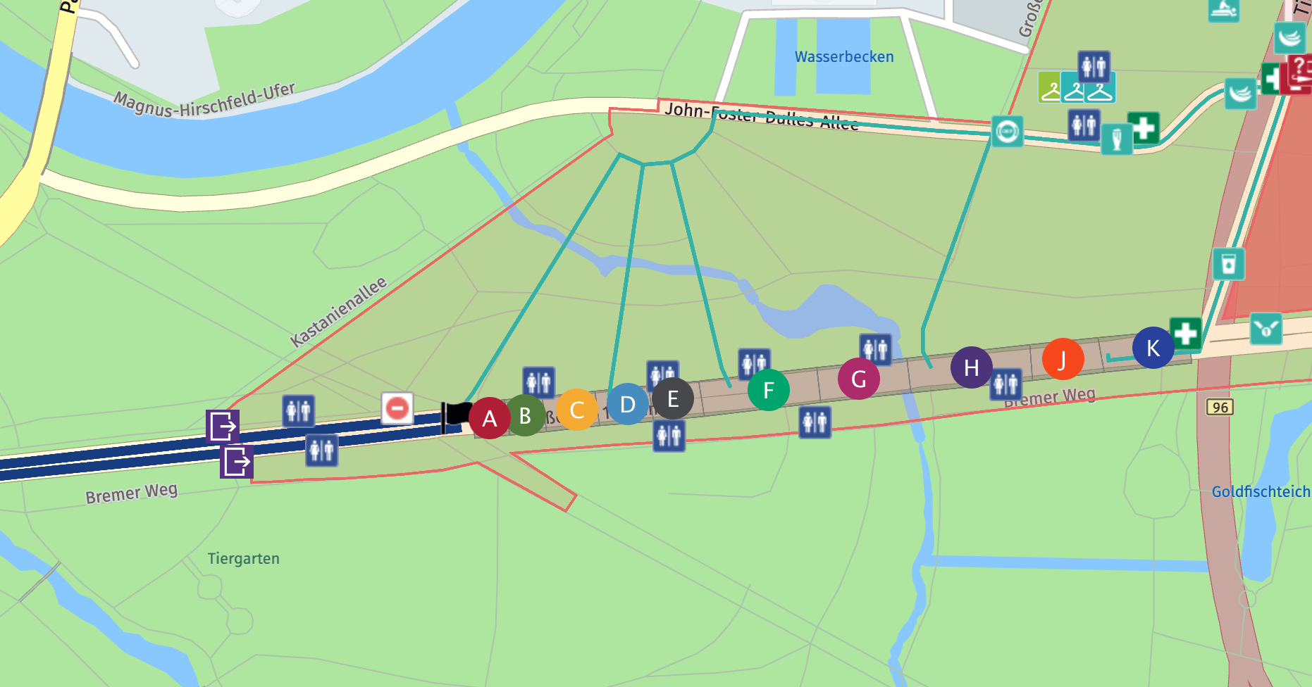
The start and finish are not precisely at the same point, but they are very close so you can count on a checkroom service.
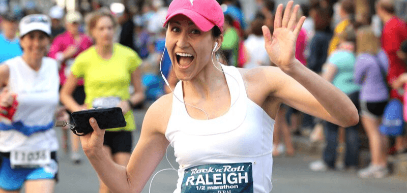
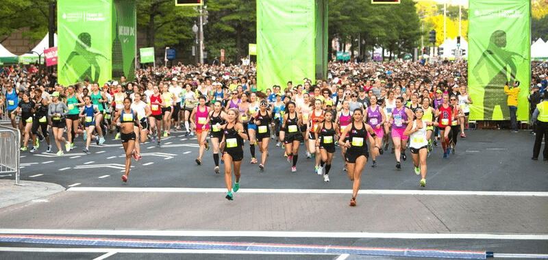
Berlin Marathon start line
Starting corrals are very well-marked and organized. It is important to know yours in advance. One of the advantages of this race is that the start is along the extensive street of June 17, which takes the marathon runners to Ernst Reuter-Platz. This means that although there are about 50,000 people, there are no funnels or problems at the start.
Remember not to start too fast and avoid running in zig zags.
From there via Otto-Von-Bismarck-Allee, Reinhardtstraße, Torstraße and Karl-Marx-Allee to Strausberger Platz.
The route runs along Lichtenberger Straße, Heinrich-Heine-Straße in the south and leads to Moritzplatz, Kottbusser Tor, and Kottbusser Damm until it finally reaches Hermannplatz in Neukölln. From there, it continues west through Yorckstraße, Grunewaldstraße, and Martin-Luther-Straße to the impressive Red Town Hall Schöneberg.
The route leads back to the city center after the marathon runners pass through Friedenau and Schmargendorf. The Hohenzollerndamm, Konstanzer Straße, and the famous Kurfürstendamm are passed until you finally reach Wittenbergplatz. From there, it goes to Potsdamer Platz via Kleiststraße and Potsdamer Straße.
Berlin Marathon Finish line
After kilometer 32 a slight downhill gradient is evident which you can take advantage of. The marathon route along the historic Leipziger Straße leads to the popular Gendarmenmarkt. It is a unique experience to pass through the impressive Brandenburg Gate on Unter Den Linden, before finally arriving at the destination at 17 June Street (same street as the start).
This route offers all participants the opportunity to experience some of Berlin’s most famous and historically essential attractions, such as:
- Reichstag (German Parliament)
- Berliner Dom (Berlin Cathedral)
- Potsdamer PlatzKaiser-Wilhelm-Gedächtniskirche (Kaiser Wilhelm Memorial Church)
- Siegessäule (Victory Column)
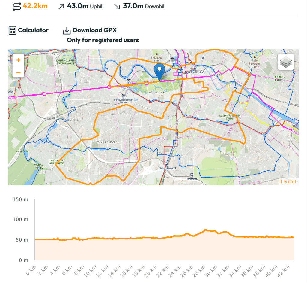
Altimetry of the Berlin Marathon course
The altimetry of the Berlin Marathon is known to be very flat, making it one of the fastest and most popular routes for runners looking to improve their personal best times. There are no bridges (like the New York Marathon route) or hills like the Boston Marathon.
Here are some details about the altimetry:
- Minimum Elevation Gain: The route has a meager elevation gain, with almost imperceptible elevation differences along the course. This means that runners do not have to face significant climbs or descents, which is ideal for maintaining a steady pace.
- Average Elevation: The average altitude of the course remains reasonably constant, hovering around 35-50 meters above sea level.
- Key Sectors: Although the altimetry is generally flat, there are some minor variations at specific points along the course, but they are not significant enough to considerably affect runners’ performance.
Download the Berlin Marathon route .GPX file, prognosis, and time calculator.
Do you want to download the Berlin Marathon route?. You can visit the GPX file here: running.COACH calendar
Create a personalized and dynamic training plan with running.COACH that optimally prepares you for your running goals based on your current fitness level, including regeneration runs. Try running.COACH free of charge for fifteen days after the first session start.

Looking for a plan that trains with you, not against you?
At running.COACH, we don’t just build a schedule. We create a smart, living plan that evolves with you. It understands your level, your race goals and your real life. Whether you sync your GPS watch or train straight from our iOS or Android app, your plan adjusts automatically as you improve.
From day one, you’ll feel the difference:
- A fully personalized, dynamic plan designed for you.
- Automatic sync and effortless workout tracking.
- Real-time updates when life happens, including missed sessions, new races or schedule changes.
- Simple, science-backed guidance to train smarter and recover faster.
🎁 Start today and enjoy your first 30 days free.
Because the best training plan isn’t one you follow. It’s one that follows you.app.


0 Comments